Car Rental in Lima: The Best Prices and How to Find the Ideal Option
Knowing the best options for car rental in Lima and finding the right price is the first step to ensuring an excellent stay in Peru’s capital and its surroundings. Getting around by car gives you comfort, safety, and most importantly, the freedom to choose your own routes and schedule. Ultimately, that’s what travel is all about: improvising and going with the flow.
Today, there are many vehicle rental alternatives, from traditional rental companies to peer-to-peer digital platforms. Of course, not all of them offer the same cost-benefit ratio.
In this article from Rentennials, you’ll find updated, clear, and strategic information about the best way to secure a car rental in Lima. You’ll also discover a complete guide to compare models, prices, and tips so you can choose the most convenient option based on the type of trip you’re planning.
What Is the Best Way to Get Around Lima?
Peru’s capital is huge and very dynamic. It offers a wide variety of experiences you won’t want to miss: coastal neighborhoods, historic centers, nearby beaches, and surprising natural escapes.
Each area has its own traffic patterns, peak hours, and access routes. That’s why relying solely on public transportation can significantly limit your options (and it’s not very efficient).
So, renting a vehicle is the best decision you can make. Before booking, it’s important to compare different car rental in Lima options and find the best prices to optimize your budget and make your experience unforgettable.
Driving in Lima: Traffic, Weather, and Tips
Before you hit the road—literally and figuratively—it’s important to understand where you’ll be driving so your transfers are as efficient as possible. The city has good mobility and signage, with wide avenues, urban highways, and fast roads connecting districts quickly. Rush hours typically occur between 7–10 a.m. and 5–8 p.m.
As for the weather, while Lima often has overcast skies, the good news is that it rarely rains, and extreme weather conditions are uncommon. Always keep basic precautions in mind, such as maintaining a safe driving distance, and of course, respecting traffic signs and speed limits.
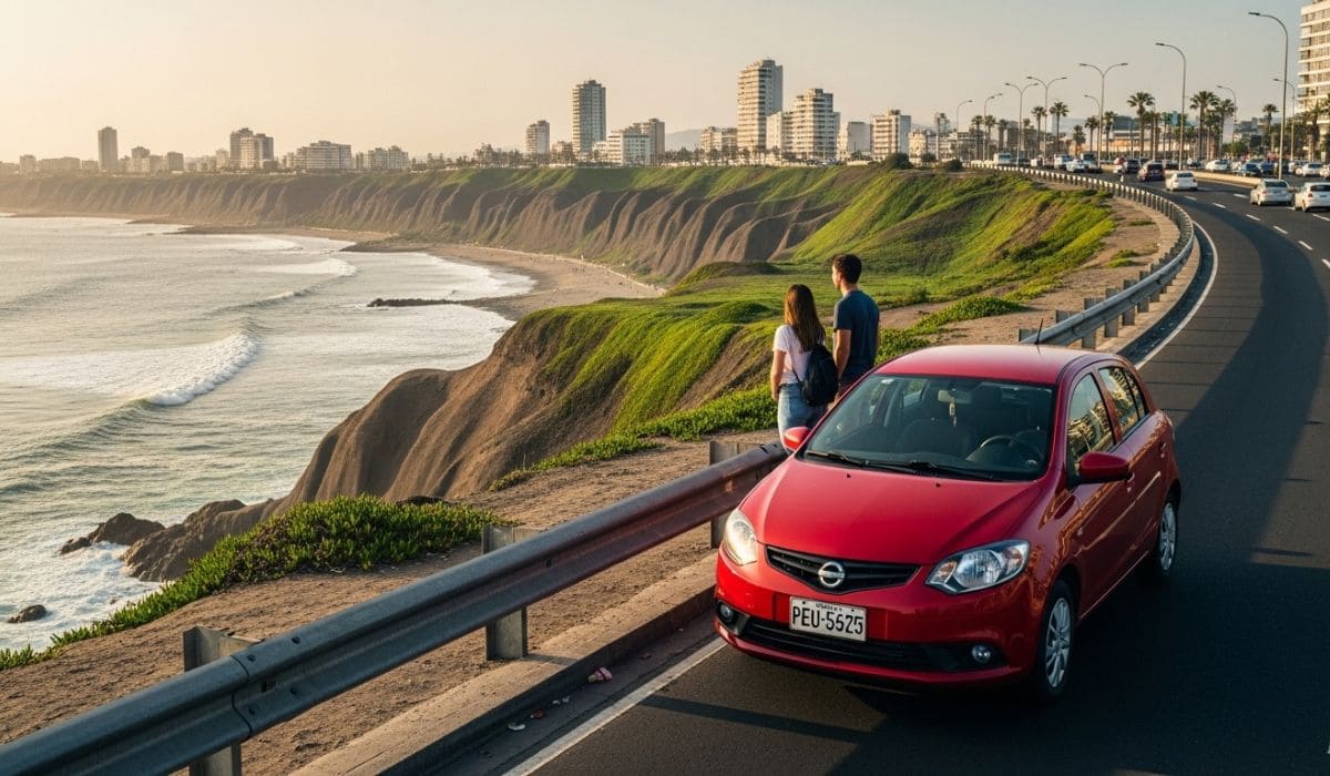
What Can You Do If You Rent a Car in Lima?
Before searching for the best car rental in Lima prices, it’s important to ask why it’s worth it. The answer is simple: having your own vehicle significantly improves your experience in Peru’s stunning capital.
Lima is a city with an enormous variety of options that are difficult to enjoy if you depend on taxis, ride-sharing apps, or public transportation.
With a rental car, you can explore places like Miraflores, the iconic Barranco, the historic center, or the city’s incredible museums and cultural spaces—all in one day.
Having your own vehicle allows you to combine beach days with a vibrant nightlife, safely and while reducing travel time to make the most of your stay. If you’re willing to go a bit farther, there are amazing excursions outside the city, including the Chancay Castle or even a trip to the dunes of Huacachina.

Which Car Model Should You Rent Based on Your Trip?
Car rental in Lima prices vary depending on the vehicle category. That’s why it’s important to understand which models best fit the type of trip you’re planning.
Economy cars, such as compact models similar to a Hyundai i10 or Kia Picanto, are ideal for city driving, fuel-efficient, and more affordable.
Mid-size sedans offer more space and power at moderate prices. If you’re planning to leave the city and want better suspension and comfort, SUVs are ideal for longer road trips with multiple travelers.
Should You Rent by the Day, Week, or Month?
Of course, time directly affects the cost of your rental, so it’s important to analyze the benefits based on the length of your stay. Daily rates offer flexibility, but they’re usually not the most economical option.
If you rent by the week, the average daily cost is lower, making it a smart choice for longer stays. In some cases, booking a full week is cheaper than paying for several individual days. For two weeks or a full month, prices drop significantly on peer-to-peer platforms, since owners prefer longer bookings.
What Factors Influence Car Rental Prices in Lima?
The final cost doesn’t depend only on the vehicle or number of days. Several variables impact car rental in Lima prices:
- Advance booking: reserving about 75 days before your trip often results in below-average rates.
- Seasonality: prices fluctuate depending on demand throughout the year.
- Type of car: smaller vehicles are typically the most affordable and popular among travelers.
- Total rental duration: the longer you book, the lower the daily rate.
Current Car Rental Prices in Lima: What Does It Really Cost?
In general terms, car rental in Lima prices vary widely depending on several factors. Rates can range from USD 40 per day up to USD 160 at traditional agencies, where administrative fees and additional charges are usually higher.
However, in recent years, peer-to-peer car sharing platforms, such as Rentennials, have gained popularity by offering an excellent cost-benefit ratio, with better prices averaging around USD 35 per day, along with greater flexibility and vehicle variety.

Digital Car Sharing Platforms vs Traditional Rentals: Who Offers Better Prices?
New ways of traveling and getting around introduce new factors to compare. Here are some key differences:
- Limited fleet vs variety and availability. Traditional rental companies operate with a fixed fleet and set pricing, which limits flexibility. Collaborative platforms like Rentennials provide greater vehicle availability, more variety, and broader categories. Additionally, peer-to-peer rentals often include local tips from owners about routes, neighborhoods, and schedules.
- Fixed rates vs supply and demand pricing. Traditional agencies offer fixed rates and often include extra charges. Collaborative platforms have lower operating costs and more dynamic pricing, which can result in better deals—especially with early bookings or longer stays.
- Fixed business hours vs flexible scheduling. Traditional agencies usually operate during office hours, while apps like Rentennials allow you to book anytime from your phone and coordinate flexible pickup locations.
So, what’s the conclusion? Compared to traditional companies, the collaborative model combines competitive pricing with a personalized experience. It also includes integrated insurance and user verification systems, ensuring a secure experience.
Tips to Pay the Lowest Price for Car Rental in Lima
If you want to optimize your budget, consider these strategies:
- Book in advance.
- Choose compact cars if traveling solo.
- Consider weekly rentals.
- Check seasonal demand before booking.
Final Tips for Choosing the Best Car Rental in Lima
Before booking, review this checklist:
- Compare prices and models. Choose what best fits your needs.
- Review the fuel policy.
- Confirm included mileage.
- Check real photos of the vehicle.
- Read user reviews.
- Confirm pickup time and location.
Rent a Car and Enjoy Exploring Lima
The car rental in Lima market is broad and competitive, and prices vary depending on many factors. The key is to compare options, understand your needs, and choose the right model.
Car sharing clearly offers advantages over traditional systems thanks to greater variety, flexible pricing, and personalized experiences. For travelers seeking freedom of movement, budget optimization, and a deeper way to explore Lima, this option is one of the smartest choices available.
At Rentennials, we want more people to travel freely and responsibly. Finding the right balance between price, comfort, safety, and flexibility is what makes every trip an unforgettable experience.
We are Rentennials
Rentennials is the new way to rent cars from local hosts in your city, quickly, easily, and affordably. It's also your new path to starting your own car rental business and making money every month.
Discover more.

Download our App


 How high is Purmamarca?