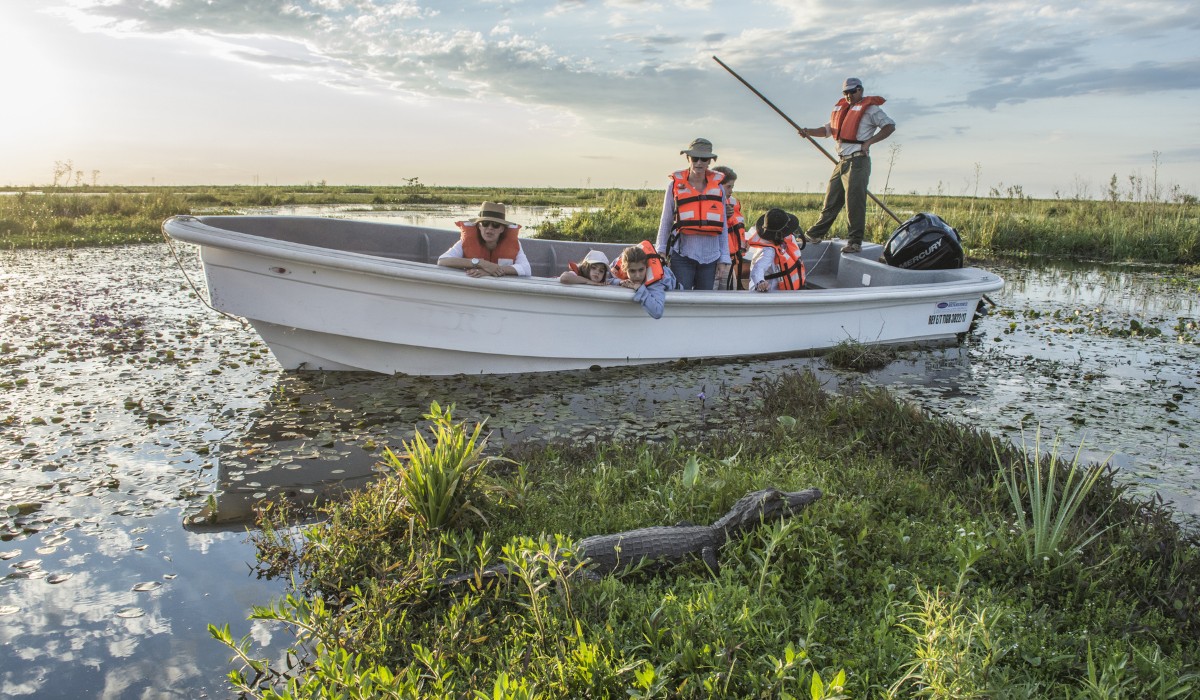
Puerto Madryn and Valdés Peninsula: 7 unmissable tips for getting to know the best marine fauna
In the province of Chubut you will find paradise to get close to whales, walk among penguins and swim with sea lions
Are you looking for a trip with a full connection with nature? There is a destination in Argentina that can give you a complete experience: Puerto Madryn and Valdés Peninsula. You will experience whale watching, sailing with dolphins, snorkeling with sea lions and walking among penguins. In just 4 days you can enjoy these activities and much more.
It all starts with renting a car in Puerto Madryn or Trelew. From there, you can explore the surroundings of the beautiful coastal city and head towards the Valdés Peninsula and the vastness of the Patagonian steppe. At your own pace, in your own way and without depending on anything other than your desire to experience unique moments.
So that you can explore the best of the Patagonian Sea by car, at Rentennials we offer you these tips with all the information you need to know to enjoy it at all times.
1. Fly to Puerto Madryn
If you are planning a short trip to Puerto Madryn, then it is best to take a plane to the city of Puerto Madryn or Trelew. Depending on the season, you may have to stop in Buenos Aires if you are leaving from a city in another province.
Trelew and Puerto Madryn are only 65 km apart, so the two cities are good alternatives to start your trip. We leave you with a recommendation: try to arrive as early as possible, so you can enjoy an extra day of travel or, failing that, the night before.
2. Rent a car in Puerto Madryn or Trelew
For travelers looking for peace, to manage their time and do the activities they really want, there’s nothing like renting a car in Puerto Madryn or Trelew and starting your trip. The distances are very short between each place and the roads are in good condition. In addition, driving through the landscapes of the Patagonian steppe has a special magic.
In Peninsula Valdés, the roads are gravel, but going slowly and taking your time you won’t have any problems.
3. Touring Peninsula Valdés by car
A World Heritage Site, Peninsula Valdés is one of the best places in Argentina to contemplate the incredible marine fauna. From August to November you have the southern right whales, a Natural Monument of Argentina. The rest of the year, you will enjoy the penguins, orcas, porpoises, sea lions and elephant seals.
To get to know the Valdés Peninsula in depth, the best way is to travel around it by car. You will stop wherever you want and observe the marine animals for as long as you have time.
Ameghino Isthmus
Upon entering the Valdés Peninsula, and after paying the entrance ticket, you will find the Ameghino Isthmus. There is an interpretive center where you can get to know the fauna you will encounter on the tour in depth.
In addition, from here there is a small path to the viewpoint of the Isla de los Pájaros, a formation that rises from the sea and in which Saint-Exupéry was inspired for the boa and the elephant. Right there is the Historic Chapel of the San José Fort, a replica of a construction from the late 18th century.
Puerto Pirámides
This small town is an excellent option for lodging and, from here, to tour the peninsula. In addition, boats leave for whale watching. It has an interesting offer of hotels, cabins and hostels and innovative gastronomic proposals.
Here, you will find the tranquility of an old fishing village. Walking through its streets with the traditional buildings of the Patagonian coast takes you back to the past.
Also, from Puerto Pirámides you can take different bike rides and guided trails to learn more about the Patagonian steppe.
Whale Watching
From Puerto Pirámides, whale watching excursions are carried out. There are different options, from the tour with a traditional boat to the submarine boat, which has a lower part to see the whales from “inside the sea”.
Along the internal roads of the Peninsula, you will reach Caleta Valdés. Here you will find the elephant seals and a colony of Magellanic penguins. During breeding season, you can also see orcas.
It is 75 km from Pirámides, on a gravel road. In the area there is a restaurant and a place to have lunch. In addition, you can stay overnight at La Elvira Natural Lodge, a ranch with accommodation and Patagonian cuisine.
Punta Norte and Estancia San Lorenzo
Punta Norte is another highlight of the Peninsula. You will visit the You can also meet sea lions and elephant seals. During the breeding season, you can also see orcas (between February and May).
Estancia San Lorenzo is home to one of the largest colonies of Magellanic penguins in the world. To enter, you have to pay an entrance fee and the entire visit must be done with a guide. In addition, there is a food and lodging service.
To get there, you have to drive about 80 km on gravel from Puerto Pirámides.
How to travel around the Valdés Peninsula
All the internal roads on the peninsula are gravel, so you have to go slowly and choose the points you want to visit. Generally, it is best to go to Caleta Valdés one day and Punta Norte the next. Connecting the two points in one day is possible, but keep in mind that driving many kilometers on gravel can be tiring. Also, you have to go slowly because of the local fauna.
Because of this, a good option is to spend a few nights in Puerto Pirámides. It is a different experience and has many accommodations of various styles and prices.
4. What to do in Puerto Madryn by car (and in the surroundings)
Puerto Madryn is a beautiful city facing the sea and known as the National Capital of Diving. Its crystal-clear waters allow you to enjoy this activity. In summer, its beaches are famous for the calm sea and, throughout the year, it has much to enjoy.
The best thing is to dedicate two or three days to the city to go to the nearby places that will not cease to surprise you: a beach where whales come close to just a few meters, a tour of the steppe to reach Punta Tombo and walk among the penguins. And finish with a Welsh tea in Gaiman.
El Doradillo
Between August and November, in the El Doradillo Protected Natural Area, you will be able to see whales from the beach. During high tide, these fantastic animals come so close to the coast that they can be observed without binoculars.
To get there, you only have to drive about 13 km north. From Puerto Madryn, you can also book whale watching excursions.
Get to know Puerto Madryn’s history
In addition to nature, the city has a rich history. In the Punta Cueva Historical Park there is the Museo del Desembarco. This site tells how the Welsh came to inhabit these lands and their encounter with the native communities. From Monday to Friday it opens from 5 pm to 9 pm. Saturdays and Sundays from 10 am until the end of the day (closed from 1 pm to 5 pm).
If you want to learn more about the history of the area, visit the Juan Meisen Ebene Museum, which is located in what used to be the railway station.
Diving and snorkelling with sea lions
In Puerto Madryn there are several areas where you can dive and enjoy a dive in the Argentine sea. Another option, for which you do not need previous experience, is to swim with the sea lions while snorkelling. The sea lions get so close to you that you will not be able to believe what you are experiencing.
16 km south of Puerto Madryn, this reserve preserves and protects sea lions. There is a viewing point to observe the fauna and a trail to learn about the flora of the Patagonian coast.
There is an entrance fee and it is recommended to go at the last hour before it closes.
Gaiman and Welsh tea
On the coast of the Chubut River and 80 km from Puerto Madryn, is the town of Gaiman, a Welsh colony and one of the most beautiful towns in the world. It is known for its tea houses, but don’t miss walking through its streets, seeing the chapels and Welsh buildings. In addition, you can visit the Gaimán railway tunnel. Today it is an interesting visit to learn about the history of the region.
In the afternoon, many decide to have tea in one of its traditional Welsh houses. Go after a light lunch because the service is very plentiful. Some options to spend the afternoon are:
A recommendation: choose one that does not receive contingents of tourists so you can enjoy yourself in peace. You can call beforehand and ask.
If you like to sleep in a place with complete peace, in Gaiman there are accommodationsthat are usually cheaper than those in Puerto Madryn.
Trelew and Rawson
The provincial capital and its neighbor Trelew have attractions that are worth visiting for a day. In Trelew you will find the Egidio Feruglio Museum, a favorite of the little ones. In this Patagonian region many remains of dinosaurs and fossils of different types have been found, and this museum condenses many of these findings. You can buy the entrance ticket in advance.
Rawson, just a few kilometers from Trelew, has the traditional Playa Unión as one of its places worth visiting in summer. In addition, from the port of Rawson Boats leave for the sighting of toninas, the dolphins of the Argentine sea.
Both cities are located about 70 km south of Puerto Madryn on National Route 3.
5. Walk among penguins in Punta Tombo
Between the months of September to April you can walk among the Magellanic penguins and be very close to them. The Punta Tombo Provincial Wildlife Reserve is in charge of protecting the largest penguin colony in the world. You can see their nests, how the little ones change their plumage (in November) and the behavior of these animals.
There is a 3 km trail of very low difficulty that is combined with viewpoints to contemplate the Patagonian sea.
How to get to Punta Tombo from Puerto Madryn
From Puerto Madryn to Punta Tombo is 188 km. Take National Route 3 until the intersection with Provincial Route 75. From there, continue to the entrance of the reserve, where the road becomes gravel (Provincial Route 1). You can check the map here.
It is best to leave early in the morning and arrive at Punta Tombo around mid-morning or midday. On the way back, you can combine it with a cup of tea in Gaiman.
6. Check the marine fauna calendar
To travel to Puerto Madryn and Peninsula Valdés, it is essential that you check the marine fauna calendar to organize your itinerary.
June to December: the southern right whales.
Mid-September to mid-April: the Magellanic penguins.
March and May: the orcas
July: the elephant seals begin to arrive.
All year round: sea lions and porpoises
And you will always be able to see guanacos, choiques, foxes and other animals of the Patagonian steppe
7. Choose the best time to travel to Puerto Madryn
Puerto Madryn and the Valdés Peninsula are beautiful places all year round. If you are looking for more heat and a bit of beach, November is the best month. However, you will miss out on getting close to the whales.
To see the whales, the best months are September or October, when almost all the marine fauna appears. Keep in mind that these months are the high season, so prices are more expensive.
Tour Puerto Madryn and the Valdés Peninsula with Rentennials
Discovering the marine fauna of the Patagonian sea is an unforgettable experience. And even more so if you do it at your own time, at your own pace and with the calm that a trip deserves.
To get to know the best of Puerto Madryn, renting a car with Rentennials is an option that makes everything easy for you. From the moment you quote your car to the return. Simple, easy and affordable. Plus, it allows you to connect with hosts and explore places you wouldn’t otherwise.
We are Rentennials
Rentennials is the new way to rent cars from local hosts in your city, quickly, easily, and affordably. It's also your new path to starting your own car rental business and making money every month. Discover more.
Barreal and El Leoncito under the most starry sky in Argentina
In San Juan you will visit Barreal and El Leoncito National Park, guardian of the best nights in Argentina.
In the province of San Juan, at the foot of the imposing Andes Mountains, lies the town of Barreal. A small town where peace pervades its streets, ideal for spending a few days of complete tranquility. Just a few kilometers away is El Leoncito National Park, one of the best places for astrotourism in Argentina. On a night visit, the experience of seeing the stars in a dark sky becomes unforgettable.
In addition, wineries, horseback riding and bicycle rides are activities that complement rest, enjoying unique views of the mountains. And if you are looking for something more adventurous, land sailing in Pampa El Leoncito and trekking to the turquoise stream are excellent options.
So that you can explore the best of Barreal by car, at Rentennials we provide you with all the information you need to know to get there and enjoy it.
Where is Barreal, San Juan
The town of Barreal is located in the southwest of the province of San Juan. Close to the border with Mendoza, this small town offers one of the best views of the Ansilta Mountain Range, a mountain range within the Andes Mountain Range system. The Patos River gives a special magic to these beautiful panoramas.
If your idea is also to do wine tourism, Barreal and nearby Calingasta are two options that meet all the expectations of travelers: good wines, gastronomy and quality service. And not only that, there is also a variety of activities, such as bike rides, horseback riding, rafting and much more.
How to get to Barreal from Mendoza
The first thing is to rent a car in Mendoza and then begin the trip to the province of San Juan. To get to Barreal, take National Route 40 to the city of San Juan. From there, continue to the intersection with Provincial Route 436 and turn left until you come across National Route 149 to Calingasta. You have to continue for about 120 km more and you will come across Barreal. About 40 km before is the town of Calingasta.
Something important to keep in mind! Google Maps suggests that the road from Mendoza to Barreal is via Uspallata and National Route 149. This route has a large stretch of gravel (even sand) that is in poor condition. Although it is shorter, with a low car you will probably have many problems getting there. If you decide to do it, it is best to go in a 4×4 truck.
How to get to Barreal from San Juan
Another option is to rent a car in the city of San Juan and start the trip. From the capital you have to go along National Route 40 until the intersection with RP 436. From this point follow the directions explained in the section above.
Created in 2002, El Leoncito National Park serves the function of taking care of the starry skies. It is one of the areas with the fewest cloudy days in the country: about 300 clear nights per year. This makes it a unique place for astrotourism. On the other hand, great care is taken to ensure that there is no light pollution in the surroundings so that researchers can do their work.
In addition, the Park is not only a place to enjoy astronomical tourism, but also has several trails to explore and get to know its particular environment. The mountain range is combined with plains and some oases.
Where is El Leoncito National Park?
It is located just 30 km from the city of Barreal. To get there, take National Route 149 south to the access and turn left. Then, continue along a dirt access where you have to be careful, but you can get there safely.
What observatories are there within El Leoncito National Park?
There are two renowned observatories in the National Park: the Carlos Ulrrico Cesco Astronomical Station (CESCO) and the El Leoncito Astronomical Complex (CASLEO). Both have specific days and times to enjoy nighttime observations.
Key tip: plan your itinerary in advance so you don’t miss the opportunity to visit the National Park and its observatories.
Carlos Ulrrico (Cesco) Astronomical Station
This station depends on the Félix Aguilar Astronomical Observatory, located in the town of Barreal. It is a great alternative to enjoy astronomical tourism activities within the National Park.
Guided tours, along with night observations, take place from Thursday to Sunday, starting during the day, you can visit the observatory at 8:30 p.m. You must book a time in advance on the Cesco website. At the end of the experience, you must return to your accommodation in Barreal.
El Leoncito Astronomical Center (CASLEO)
This observatory, which is part of CONICET, is perhaps the most outstanding of the two. During the day, you can tour its facilities, while at night, they offer astronomical observations. It is usual to arrive around 7 p.m. to take the guided tour, which includes a tour of the observatory. When night falls, you are invited to look at the sky through one of their external telescopes. At the end, you return to your accommodation in Barreal.
With some planning, there is the possibility of spending a night at CASLEO. On certain days and when there are no scientific activities, they open the accommodation for tourism, which includes dinner and breakfast.
In both cases, it is key to check the opening of quotas at the beginning of each month and make the reservation directly on the CASLEO website. On Fridays and Sundays, only observations are made, while on Mondays and Saturdays you can stay overnight.
How to do astrotourism in El Leoncito
It is an activity suitable for the whole family and the intention is to discover an immense sky with the guidance of experts. Here are some tips to keep in mind:
Don’t go without a reservation. Since there are only a few days, the places fill up quickly. Do you already know when you are traveling? Then start making your reservation now.
Bring a coat. Observations are made at night and temperatures drop considerably. In winter, we recommend that you be well equipped.
Don’t go on nights with a full moon. The further away you are from those dates, the better.
Being open to new, unknown experiences is essential for you to enjoy this unique visit in Argentina.
What to do in Barreal
Whether before or after the astronomical tourism experience in the National Park, you can do many activities or, if you prefer, rest in the accommodations in Barreal.
Here we tell you everything you can do in this beautiful area of San Juan.
Land sailing in Pampa El Leoncito
Do you like speed and wind? Then Barreal is the best option for you. In Pampa El Leoncito, a plain that was once a lagoon thousands of years ago, you can practice land sailing. It is a sailboat driven by the strong winds of the region.
You have to do it on windy days (but not too much) and, preferably, in the afternoon. Only hire authorized providers to ensure an experience with all the safety elements.
It is located in front of the National Park, so it is very easy to get to. A few days before you will know if you can do the activity, because the wind speed is known.
Trekking to the Turquoise Creek
After about eight hours of walking (medium difficulty), you will reach one of the most impressive water courses in the Cordillera. This is a stream that falls from the mountain and, due to its mineral properties, has a turquoise color.
Tranquility invades the town of Barreal, and there is nothing like touring it on horseback or by bike. There are multiple options, but they are all half-day trips to get to know the area. Some include a country-style lunch.
Another option is rafting and kayaking on the Río de los Patos. The experiences are of low difficulty and suitable for the whole family.
Trails in El Leoncito National Park
If you want silence and only to hear the sound of the fauna, then before going to the El Leoncito observatory, walk the trails in the National Park. There you can walk through the arid landscape and, perhaps, come across foxes and guanacos.
The trails in El Leoncito National Park close at 7 pm, so it is advisable to arrive around 4 or 5 pm to be able to enjoy them in their entirety. After touring them, you can try astrotourism.
Wineries in Barreal
The wine tourism circuit in Barrial is incipient and increasingly offers better places for those who want to taste San Juan wines and have lunch with views of the mountain range.
Here we leave you only a few options. Always call before going to make a reservation (not all offer lunch service).
Remember that if you drink alcohol, it is best to leave your car at your hotel and go by remise or taxi to the wineries.
Where to stay in Barreal
This is an area where tourism has grown a lot in recent years, which means that there is an increasing supply of accommodation. There is something for all budgets and styles, from hostels, boutique hotels and cabins.
Any advice? In summer, book a room One with a pool. And all year round, look for one that has a direct view of the mountain range.
When to visit Barreal and El Leoncito National Park
It is one of the destinations that can be visited all year round, but there are better times than others. In summer, as in the entire Cuyo area, temperatures tend to be high, although with a dry heat. In winter, the nights are very cold, which can make stargazing difficult.
The best time to visit Barreal is in autumn and spring.
Get to know San Juan and Barreal with Rentennials
Another destination that, if you don’t know yet, you have to start planning your trip now: stars, wines, horseback riding, rafting. And all very close to the city of Mendoza and the capital of San Juan.
The best way to get around Barreal is by car. At your own pace, with your interests, and knowing that there is always time for rest and for the activities that you like the most. The roads are well maintained and you will experience driving through beautiful landscapes. Renting a car with Rentennials allows you to connect with hosts and discover places you might not otherwise get to.
We are Rentennials
Rentennials is the new way to rent cars from local hosts in your city, quickly, easily, and affordably. It's also your new path to starting your own car rental business and making money every month. Discover more.
The province of Córdoba is a world to discover, and Traslasierra has everything to spend an unforgettable vacation.
The Talampaya National Park and the Ischigualasto Provincial Park are two of the most surprising destinations in Argentina. You will find high canyons, geological formations that look like moles and colors that change in just a few kilometers. Both parks, located in La Rioja and San Juan, invite you to learn about the history of our land.
Visiting them is simple and you can do it in a few days if you have a car. But the best thing is to take your time and explore each place to discover. Sometimes, with two or three more days on your trip, you get to see places that surprise you more than you initially planned.
At Rentennials we want a getaway to Córdoba to become an unforgettable moment. That’s why we offer you this guide with the best information to explore Traslasierra.
Córdoba
Where is the Traslasierra Valley in Córdoba?
There are ten tourist regions in the province of Córdoba. Some of the best known are:
The Punilla Valley is north of the capital. It extends from Carlos Paz to La Cumbre on RN 38.
The least explored is the North of Córdoba. It begins on RN 9, in Deán Funes. It crosses the royal road and one of the most beautiful towns in the world: Villa Tulumba.
The Calamuchita Valley. It is accessed by RN 5, and there you will find Los Molinos, the Río Tercero Reservoir and other places to enjoy different activities.
The Traslasierra Valley. From Mina Clavero to the border with San Luis along Provincial Route 14. You will find towns and a unique mountain landscape.
There are several options to get to Traslasierra from the city of Córdoba. The first is to take Provincial Route 34 south towards Alta Gracia. After passing Falda del Cañete, you have to turn right towards Las Jarillas. Continuing along the same route, you cross the Las Altas Cumbres road, with a stunning scenic landscape. Finally, you reach the first city of Traslasierra: Mina Clavero. Here is the map with the suggested route.
Another option is to go slower and make a short stop in Alta Gracia. Taking National Route 36 from Córdoba to the south, you reach Alta Gracia after traveling 50 km. From here, you must continue along RP 34 until the intersection with Las Altas Cumbres road. This alternative is a little longer, but you will get to know one of the most emblematic cities in the province: Alta Gracia.
Must-see places on a road trip through Córdoba
On your journey to Traslasierra from the city of Córdoba, you will find unforgettable landscapes, a National Park and a historic city that you cannot miss. Below, we will tell you about the must-see stops to make on your route to Traslasierra.
Alta Gracia, a place with history
The history of the city of Alta Gracia begins around the 17th century. The Jesuit missions made their presence felt and shaped the identity of this town. Later, around the 20th century, it was one of the places that Ernesto “Che” Guevara’s family chose to live in.
All of this can be seen in two unmissable places that travelers must visit:
The Museo Casa del Che. For health reasons, Ernesto Guevara’s family decided to live in this city. Today, it is a house museum that covers the entire life of the revolutionary leader. Admission is paid and it is open every day from 9 a.m. to 7 p.m.
In addition, you can visit the oldest dam in Córdoba, built by the Jesuits: El Tajamar. And don’t forget to walk through the Parque del Sierras Hotel.
Alta Gracia has a wide range of hotels of different categories. Find out the best places to stay!
Camino de Las Altas Cumbres
Provincial Route 34 crosses the Cumbres de Achala, the highest mountain ranges in the province. This is the path known as Las Altas Cumbres, and all travelers should take it at least once during their visit to Córdoba. In addition, it is one of the most emblematic Scenic Routes in the province
Along the route you will find some viewpoints to take the most beautiful panoramic views of the province. There are restaurants and diners to stop if necessary.
Córdoba
Mirador Quebrada del Batán
After traveling a few kilometers through Las Altas Cumbres, there is a path 130 meters from RP 34 that leads to the Batán ravine viewpoint. From here you can see a complete scene of the province: Carlos Paz, the San Roque dam and the capital.
If you are lucky, you can see the Andean condors, the emblematic bird of Argentina.
A recommendation: hire qualified guides because there are no signs. In addition, you will reach the Escondida waterfall, where you can practice rappelling.
Quebrada del Condorito National Park
Córdoba has a not-so-well-known National Park. You have to take your time, but the trip is worth it to be able to observe these magnificent birds. From La Pampilla, at approximately kilometer 59.5 of RP 34, you will reach the visitor center. From here, the route begins towards the Río de los Condoritos ravine and the balconies for bird watching.
Another alternative is to take the more visited Balcón Norte. It is a 4-hour round trip hike, with a medium difficulty.
Córdoba
To Mina Clavero via RP 14
To get to Mina Clavero there is an alternative for adventurers. A 28 km gravel road along RP 14. Along the route, San Gabriel Brochero, the Argentine saint, is remembered.
The Traslasierra Valley in Córdoba, a destination to rest
The towns of Traslasierra are synonymous with rest and nature. They are ideal for those looking to disconnect in accommodation with views of the mountains, but who at the same time want to go hiking, trekking and enjoy the streams.
The first thing you have to do on your trip to Traslasierra is choose the town where you are going to stay. So, here are some suggestions for you to organize your travel itinerary in the province of Córdoba.
What towns are in Traslasierra
From Villa Cura Brochero and Mina Clavero to the south, there are many towns to spend a few nights in complete peace. Nono, Villa Las Rosas, San Javier and Yacanto are just a few options. There are accommodations for all budgets and styles.
RP 14 is the backbone of the entire route. The best way to make the decision is to choose the town that suits your needs.
Villa Cura Brochero
This town honors the first Argentine saint, San Gabriel Brochero, who lived in the area. It has numerous attractions, such as the Centenario square with a monument to the saint, while the remains of the priest are kept in the Nuestra Señora del Tránsito church and the Brocheriano Museum. This museum is worth exploring, open every day from 10 a.m. to 1:45 p.m. and from 6:30 p.m. to 9:30 p.m.
If you are looking for nature, the trail to La Gloria waterfall is the best option. With almost 15 km, it starts from Plaza Centenario and runs through beautiful places in the mountains to one of the most famous waterfalls in Traslasierra.
Córdoba
Mina Clavero
Mina Clavero is the most visited destination in Traslasierra. It has three main rivers and numerous streams to enjoy the freshness of its waters. The Mina Clavero River is the most recognized and has several spas along its route: La Toma, Nido de Águila and La Residencia. Beaches, water holes and natural slides are just some of its attractions. Its beauty made it declared one of the “7 natural wonders of Argentina.”
The Panaholma River has the Los Cedros spa. It is more familiar due to its calm waters and shallow depths. Finally, the Los Sauces River has drawers and deep pools.
In the town there are accommodations for all budgets. If you go in summer, it is best to book in advance. This way, you can guarantee more affordable prices and the most beautiful places.
Córdoba
Nono
Its adobe buildings already indicate that we are in a town with a great history. Here there are two rivers that run through the area: Los Sauces and the Chico River. There is a place where both water courses meet, transforming the landscape into something unique.
The Las Tropas and Los Remansos spas are the best known in the area, ideal for enjoying the day. For those who prefer activities in full contact with nature, there are trails, bicycle tourism and horseback riding. For more information, go to the official tourism page of Nono.
If you are looking for a place with more tranquility, Nono is a good option.
Villa de las Rosas and Los Molles
Another town in Traslasierra full of rivers and streams. A few kilometers away is the La Viña Dam, perfect for water activities. In addition, you can take trails with different levels of difficulty. The best known are La Calandria, El Picahueso and Los Jilgueros.
Nearby is the town of Los Molles where the El Hueco Nature Reserve stands out. It is a forest with the oldest and largest trees in Córdoba. But be careful, the level of difficulty is high to get to this place. It is 24 km round trip.
San Javier and Yacanto
The calm and tranquility make these two towns the ideal destinations for rest and contact with what many seek: nature, disconnection and the silence of the mountains.
In addition, there is the possibility of trekking to ascend to the Ferreyra post. It takes 4 hours, 12 km in total, and the difficulty is medium. The area is known for its horseback riding and cycling tours.
We’ll leave you with something not so well known: there are wineries where you can taste the wines of the area:
One of the last towns in Traslasierra before reaching San Luis. Trails, horseback riding and regional products are what make this place special. It is known for being the paradise of aromatic herbs, as well as having its olive path.
An ideal town to stay in complete tranquility.
La Paz
Its dirt streets, its houses and the calm transform this town into a unique place in Traslasierra. Almost on the border with San Luis, La Paz lives up to its name. Horseback riding, hiking, streams and bike rides are the must-do’s. And always with the peace of the mountains.
One kilometer away is Loma Bola, a hill with a small area named after it. There is a famous hotel with a restaurant where it is worth having lunch or spending the night.
Most of the cabins and accommodations have beautiful views of the mountains.
Climbing Champaquí Hill
Its 2,790 meters make the hill one of the most popular adventures in the Traslasierra region. During the journey you will encounter high plains, rocks with particular shapes, ravines and streams. And when you reach the top, the view will reward the effort made.
From San Javier, Villa Las Rosas and Los Molles there are accesses to climb Champaquí Hill from Traslasierra.
The duration of the journey lasts between 8 and 10 hours. It is very important to go with local guides and register before climbing. It is an experience for which you have to be prepared: bring water, trekking shoes and a desire to walk.
Throughout the towns of Traslasierra, there are accommodations of all kinds and for any budget. Campsites, boutique hotels, cabins and traditional hotels are present in each town.
If you are looking for a place with more restaurants and services, Mina Clavero is the right place. If you are one of those who prefer tranquility, Luyaba, San Javier or La Paz may be your place. Nono and Villa Las Rosas are towns with a little more accommodation and gastronomy.
In summer or winter, call a few months in advance to reserve.
Rent a car with Rentennials to tour Córdoba
Traslasierra in Córdoba is that place you arrive at and you will not want to leave. Starting with the beautiful Altas Cumbres road, all the way to the border with San Luis, each town, stream and trail has a special magic. All year round, it is ideal for a restful break.
The car is the quickest and easiest way to get to know each of these places in Córdoba. Renting one with Rentennials is the ideal option for those who prefer flexibility, low cost and reducing environmental impact.
We are Rentennials
Rentennials is the new way to rent cars from local hosts in your city, quickly, easily, and affordably. It's also your new path to starting your own car rental business and making money every month. Discover more.
How to travel by car to Talampaya and the Valley of the Moon, destinations with landscapes from another planet
San Juan and La Rioja have two places with unforgettable natural scenes. Go ahead and discover them.
The Talampaya National Park and the Ischigualasto Provincial Park are two of the most surprising destinations in Argentina. Their high-altitude canyons, geological formations that look like the moon and colors that change in just a few kilometers. Both parks, located in La Rioja and San Juan, allow you to learn about the history of the formation of what is today our land.
Visiting them is simple and can be done in a few days if you have a car. But it’s better to take your time and explore each place. Sometimes, spending two or three more days on your trip allows you to discover places that are much more surprising than you imagined.
At Rentennials we want to help you get to know Talampaya and Ischigualasto with the best tips for planning your itinerary.
Parque Nacional Talampaya
What are the Talampaya and Ischigualasto parks?
Each park has its own geological peculiarities and a history that are combined at all times. While the Talampaya National Park is in the province of La Rioja, its neighbor, the Ischigualasto Provincial Park, is located in San Juan.
Below, we tell you a little more about each one so you can discover which places to visit on your next trip.
Talampaya National Park
The Talampaya National Park was created in 1997 and covers some 215,000 hectares. Since 2000, it has also been a UNESCO World Heritage Site. Its rock formations are of Triassic origin, which tells us about millions of years of history. Hundreds of fossils have been discovered in the area, which can even be seen during the tour.
Its desert landscape and the reddish canyons of surprising height mean that thousands of travellers visit this Riojan destination every year. In addition, with a bit of luck and if you dare to take a different route, you will see the fauna of the area.
Ischigualasto Provincial Park
Ischigualasto is located in San Juan and is known for its greyish landscapes that remind us of the moon. Its geological peculiarity led to it being declared a World Heritage Site in 2000.
With an area of 62,000 hectares, this natural space protects unique formations from the Triassic period. The fossils found here reveal many key aspects to understanding the evolution of life on Earth. These sought-after photos are the formations known as “El Submarino”, “El Hongo”, or the strange “Campo de bochas”.
How to get to Talampaya and Ischigualasto by car
Depending on where you start your trip, there are three possible ways to get to Talampaya and Ischigualasto. The best way is to rent a car in Mendoza, San Juan or La Rioja and begin your journey along the Argentine roads.
From San Juan
Starting from the city of San Juan, take National Route 40 to the north. When you reach Huaco, turn right onto National Route 150, where you will find the access to the Ischigualasto Provincial Park.
To go to Talampaya, continue along the same route until the intersection of Baldecitos. There, turn left onto National Route 76 until you reach the access to the National Park.
From San Juan to Ischigualasto there are 300 km, and to the access to Talampaya it is 380 km. The road is paved and in perfect condition. Here is the map to get there.
From La Rioja
From the capital of La Rioja, take National Route 38 south to Patquía. There, turn right onto National Route 150 to the access to Ischigualasto. A few kilometers before, you will find National Route 76, which takes you directly to Talampaya.
From La Rioja to Ischigualasto there are 180 km, and to the access to Talampaya it is 240 km. This is the suggested route.
Although this route is shorter, the difficulty lies in the fact that if you fly to La Rioja you have fewer flights. This can complicate the organization of your trip.
From Mendoza
This option is longer, but is chosen by many travelers due to the excellent air connection that the city of Mendoza has with other places in the country.
The road to get to Ischigualasto and Talampaya is the same as that of San Juan, explained above. The total distance is 450 km to Ischigualasto and 500 km to Talampaya.
Distance from Talampaya to Ischigualasto
Between the entrance to the Ischigualasto Provincial Park and the entrance to the Talampaya National Park there are only 80 km. This distance allows both parks to be visited in one day.
Where to stay to visit Talampaya and Ischigualasto
There are three towns that offer hotels and restaurants: Villa Unión, San Agustín del Valle Fértil and El Chiflón. In each one, in addition to visiting the parks, you can visit some nearby places that are really worth visiting.
Parque Nacional Talampaya
Villa Unión
The most common option is to stay in Villa Unión, the closest city to Talampaya, and prepared to receive tourists. There are only 60 km between both places. In this town, there is a wide range of accommodations and restaurants to enjoy after a tour of the parks.
In Villa Unión, all-day excursions to visit Laguna Brava depart. In addition, you can visit Cuesta de Miranda, the Famatina region and Chilecito.
San Agustín del Valle Fértil
Another option is to spend a few nights in San Agustín del Valle Fértil in San Juan. It is 72 km to Ischigualasto, and then 80 km to get to Talampaya.
This town has many other activities to enjoy nature, such as horseback riding, bicycle tours and trails.
El Chiflón
An alternative is to spend the night in El Chiflón, a place very close to both parks that has accommodation with a very attractive proposal for the area: The Hotel Chiflón Posta Pueblo. It has a restaurant with very tempting cuisine and different activities.
How to visit Talampaya and Ischigualasto
Both parks can be visited by the whole family. The ways to visit them are accessible to all travelers and very simple. However, there are alternatives out of the ordinary that require a little more planning and travel time.
Below we tell you how to do the classic and the alternative in each of the parks.
The best ways to visit Ischigualasto
By car, bicycle or on foot, the circuits are varied and can be adapted to what you are looking for. In addition to doing the traditional circuit, you can also discover the others.
Traditional circuit
There are 40 km that are done in a caravan in the visitors’ cars. Along the traditional circuit, five stops are made to see the best places in the park. The Mushroom, the Submarine and the Bowling Field are some of the classics that you will not miss.
The tour lasts 3 hours, it is on a first-come, first-served basis and there are set departure times: 8, 9, 10, 11, 16 and 17 hours.
It is the one that you definitely have to do, and you can complement it with trekking or the bike tour.
Cambo de Bochas en el Parque Provincial Ischigualasto
Mountain bike circuit
This way, you can reach less visited areas of the park and, at the same time, you can more easily encounter the local fauna.
It is done with a guide, the route is 12 km, with a duration of 1 hour and 30 minutes, and is for people over 14 years old. The Provincial Park provides you with bicycles for the tour. The departure time is at 4:30 pm and it is necessary to book. You can do it by WhatsApp at the numbers 264 457 0879, 264 418 6119, or by email at reservas.ischigualasto@gmail.com.
The ideal is to do the tour by car in the morning and, in the afternoon, do the tour by bike. It is important to keep in mind that it can be suspended due to weather conditions.
Cerro Morado and Río Salado hiking circuits
These are two different circuits that offer walks to further explore the park’s unique features. The Cerro Morado circuit takes you to the highest point in the Provincial Park. With the Río Salado circuit you walk along the river bed to a waterfall and an emerald-colored lagoon.
Both last 3 hours and departures are subject to availability. To book, send a WhatsApp to 264 457 0879, 264 418 6119, or by email to reservas.ischigualasto@gmail.com.
If you are going to do it, keep in mind that with these circuits you will not get to see the most famous places in the park. It is always best to do the tour by car in the morning and, in the afternoon, with lower temperatures, go on walks.
Full moon circuit
A unique experience. This tour allows you to enjoy the full moon illuminating the natural monuments of the park while you walk in the clearing of a dim light. It is like being in the middle of a lunar landscape.
It takes place on the four nights of the full moon each month, and it is very important that you make the reservation on the first day of each month. It can be suspended due to weather conditions.
You must send a WhatsApp or an email to make the reservation.
How to tour the Talampaya Ischigualasto National Park
Like Ischigualasto, the Talampaya National Park offers different circuits to get closer to these natural sculptures sculpted by water and wind. You can live a complete experience and discover landscapes outside the classic circuits.
Tickets for each of the circuits are purchased at the entrance to the park, or you can go ahead and buy them on their website.
Los cañadones del Parque Provincial Talampaya
Traditional Talampaya Canyon Tour
With this circuit you will get to know each unmissable attraction of the Talampaya Canyon. It is done in a vehicle specially designed for this purpose and with a guide. In addition to getting to know the rock formations, you will connect with the culture and history of the region.
The duration is about two and a half hours, and the departure times are at 09:00, 13:30 and 16:00. It is best to do it at the first or last hour, due to the heat and light. We recommend you book your ticket in advance.
Talampaya Canyon and Shimpa Canyon
This tour in a 4×4 truck covers the entire Talampaya Canyon and Shimpa Canyon. You will visit the same places as with the traditional excursion, but at the end you will arrive at a unique destination.
Finally, you will visit the carob forest of the Shimpa Canyon with a walk along the dry riverbed. At your sides you will have walls of more than 80 meters high.
The duration is four hours, and the departure times are at 10:15 AM and 2:30 PM. To ensure your place, reserve your ticket in advance.
Trekking through the Talampaya Canyon and Los Balcones
For adventurers and those looking to get off the beaten track. First, you will visit the park’s most famous attractions by vehicle. Then, you will hike up about 2.3 kilometers to Los Balcones de Talampaya, a viewpoint at 1,600 meters above sea level from which you will contemplate an impressive landscape.
It is done with a guide and lasts 4 hours. Departure times are at 09:00 and 13:30 (we recommend the first option due to the heat).
Visit both parks in one day. However, we suggest you take a little more time to do some alternative excursions, such as Laguna Brava, Cuesta de Miranda or do the different activities in the parks.
If you choose this option, the ideal is to start early in the morning in one of the two parks, depending on where you are staying. After lunch, you will set off towards the other park for a more traditional visit.
How many days do you need to visit Talampaya and Ischigualasto?
For a complete visit, enjoying not only the classic circuits, at least 3 days are necessary. One day for the Ischigualasto Provincial Park, another for Talampaya and a remaining day to rest or do some alternative activities. Here are some options:
Excursion to Laguna Brava. This is a full-day 4×4 climb to the top of the Andes. You will find a lagoon at more than 4000 meters above sea level.
Cuesta de Miranda. A beautiful scenic road along National Route 40 that connects Villa Unión with Chilecito.
Famatina and Chilecito. It is an area of vineyards and walnut production, ideal for spending the day touring the Riojan landscapes.
Get to know San Juan and La Rioja with Rentennials
Argentina has unmissable destinations that we must visit. Talampaya and Ischigualasto are places that we can visit in a simple way over a long weekend or, alternatively, spend a whole week there.
The best way to get around San Juan and La Rioja is by car. The roads are in good condition and you will have the experience of driving on routes with very little traffic. Renting a car with Rentennials is the best option for those who want simplicity, low costs and to generate a benefit in the regional economy.
We are Rentennials
Rentennials is the new way to rent cars from local hosts in your city, quickly, easily, and affordably. It's also your new path to starting your own car rental business and making money every month. Discover more.
Unmissable guide to activities and excursions to do in Cafayate, Salta
In the Calchaquí Valleys, Cafayate has magical places to visit and spend the best vacations.
If you’re wondering what to do in Cafayate on a long weekend or a week of vacation, here you’ll find the activities you can’t miss. In the heart of the Calchaquí Valley of Salta, the historic city of Cafayate has everything: wineries, treks, excursions for the whole family and essential driving tours.
Renting a car in Salta is the first step to organizing your trip. From the capital, you will drive through ravines until you reach Cafayate. It is not a long journey, but it is worth doing it at your own time and pace.
At Rentennials we want people to be able to enjoy the country without rushing, in an economical way and to get to know those hidden corners that Argentina has. Therefore, here we leave you all the information to prepare your travel itinerary to the province of Salta.
Cafayate
Where is Cafayate?
Cafayate is located in the south of the province of Salta, 200 kilometers from the provincial capital. It is very close to the border with Tucumán, which makes it a perfect destination if you are traveling from the capital of that province.
It is the most important city in the Calchaquí Valleys, and many travelers choose it as a base to tour the area.
From San Miguel de Tucumán to Cafayate by car
From the city of Tucumán to Cafayate, take National Route 38 south and then turn right onto Provincial Route 307. This is a mountain road with curves and counter-curves, so it is best to go slowly.
You will pass through Tafí del Valle and Amaicha del Valle, two towns surrounded by beautiful mountain landscapes. If you have time, it is worth staying a few nights and exploring their surroundings.
To get to Cafayate from Salta, take National Route 68 south. It is a road that begins to offer beautiful landscapes from the town of Alemanía. As we always recommend, it is best to go slowly and stop at the points that are worthwhile to contemplate the landscapes.
Unmissable stops on the route from Salta to Cafayate
On the route that goes from Salta to Cafayate there is one of the most beautiful scenic routes in the country: the Quebrada de Las Conchas. Here, you will drive through unexpected landscapes and there are many points to stop and enjoy. Therefore, it is best to do it with time and dedicate practically a day to this route.
Below we leave you with places you cannot miss.
Cafayate
Town of Alemanía
After traveling 115 km there is a small place that is worth visiting: Alemanía. You can walk around and see what the old train station is like. There is a restaurant there today to taste the flavors of Salta (open from 9 a.m. to 6 p.m.).
Quebrada de las Conchas Scenic Route
Starting from Germany, the landscapes begin to turn red, the geological formations are transformed and it becomes necessary to stop at each of the points indicated by the signs.
The places where you have to stop and, at times, walk are the following:
Garganta del Diablo (km 141). It is one of the most visited places in the Quebrada. It is accessed after a short walk. In summer it is best to visit it early or late in the afternoon.
The Amphitheatre (km 142). It is a naturally formed space that has perfect acoustics.
Mirador Tres Cruces (km 146). A stop that you have to make. From here you will contemplate the beauty of the Calchaquí Valleys.
The Toad and the Obelisk (km 153 and 165). As their names indicate, they are geological formations that resemble the reptile and the traditional monument of the Egyptians.
La Yesera (km 161). To get there you will have to walk along the Los Estratos trail. It takes about half an hour and is of low difficulty.
Los Castillos (km 169). You will find some beautiful shapes sculpted in the mountain that will surprise you.
A fact: at km 126 is the Morales Bridge. One of the most famous scenes from Wild Tales was filmed here.
Cafayate
What to do in Cafayate
Once you arrive in this magical city, all you have to do is enjoy what it has to offer. Whether in the surrounding area or in the city, Cafayate has activities for the whole family.
It stands out for being a historic city, with streets that go back to the past and architecture typical of northern Argentina. In addition, from here you can visit the high-altitude wine cellars, with the Torrontés grape variety as the star of the region.
Below, we leave you with some of the best activities to organize your trip.
Get to know the city
It is a colonial-style city that has a great offer of accommodations, restaurants and all the services for tourism. The artisan market and the Museum of Vine and Wine (open from 9 a.m. to 5 p.m., except Mondays) are the places you have to visit. In the center of the city you can enter the beautiful Nuestra Señora del Rosario cathedral built in 1885.
Don’t miss walking through the streets calmly, and having a wine ice cream in its classic ice cream shops
Community tourism
For those looking for close, authentic experiences and connecting with the culture of Argentina, Cafayate is the place. From horseback riding, artisan workshops, walks learning about the history of the place and the customs of the native peoples.
For lovers of hiking in amazing landscapes, Cafayate will not disappoint you. In general, the treks are of medium or low difficulty. It is best to go accompanied by a guide to be able to enjoy without worries and knowing every story that the region has to offer.
Los Medános. Unexpected, but here there are some dunes to ride or walk. Only 6 km from the city-
Walk through the Quebrada de las Conchas. It is another way to explore these particular rock formations. Through a half-day tour with a guide.
Cerro San Isidro. To climb you have to have about two or three hours. The view you will find is worth the effort.
Siete Cascadas. It is a three-hour walk. You cross ravines and rocks until you reach the waterfalls and their pools of water. It is mandatory to go with a guide because there are no signs and the difficulty is high. Both in the city and in the surroundings, you will be able to find local guides.
Which wineries to visit in Cafayate
The emblem of the area is the high-altitude wine. In the wineries of Cafayate you can enjoy an international-level lunch while tasting the best wines of the region. In some you can even spend a few nights. And the best: the views you have of the Calchaquí Valleys.
It is best to book in advance, and more so if you visit Cafayate in high season or on a long weekend.
Nearby places to visit in Cafayate
The car will allow you to visit some sites just a few kilometers from the city. In one day, you can tour the Quebrada de las Flechas, reach the town of San Carlos or walk through one of the best archaeological sites in the country.
Quebrada de las Flechas
It is a 10 km journey along National Route 40. During this short journey you will see inclined rocks that look like arrows.
It is located almost 70 km north of Cafayate. The road is gravel, so it is advisable to go slowly.
Cafayate
San Carlos
One of the magical towns of Salta, and one of the places with the most history in Argentina. In its streets you can see mansions, artisans and many stories of the peasant communities.
It is one of the most important archaeological sites in the country. The Sacred City of the Quilmes was inhabited around the 12th century, and today you can visit the remains of its residences and the fortress that is located on top.
Before taking the tour of the protected area, do not miss visiting the Interpretation Center that is located at the entrance. This way, you will be able to understand much more about how this town lived.
The length of the visit depends on your schedule. It is best to visit it in the morning or a few hours before closing time, so you can enjoy it without the midday heat.
It is located 54 km from Cafayate. To get there, take National Route 40 to the south. It is open every day from 9 a.m. to 6 p.m.
Cafayate
The best time to visit Cafayate and the Calchaquí Valleys
Cafayate is beautiful all year round. From December to March the temperatures are warmer, but what can prevent you from enjoying each place is the rain.
The best months to visit Cafayate and tour the Valleys are between March and June, and between August and November.
Where to stay in Cafayate
In Cafayate you will find accommodations for all budgets. In addition, there are proposals from the highest level to campsites with all services.
One car, one road, one ravine in northern Argentina. Touring Salta at your own pace and without worries is the ideal plan for a pleasant vacation. Cafayate awaits you with all its activities.
The roads to get to Cafayate and those that take you to the must-see places nearby are in very good condition. This makes renting a car with Rentennials the best option for touring the Calchaquí Valleys of Salta, and for responsible travelers looking for sustainability and generating a positive impact on the local population.
We are Rentennials
Rentennials is the new way to rent cars from local hosts in your city, quickly, easily, and affordably. It's also your new path to starting your own car rental business and making money every month. Discover more.
A road trip from Mendoza to the La Payunia Provincial Reserve by car
Throughout the year, get inspired to visit one of the largest volcano fields in the world: La Payunia Provincial Reserve in Mendoza.
The province of Mendoza is a world to discover. Potrerillos, Cacheuta and the Aconcagua mountain are the classics that everyone wants to see on a first visit. Then, the wineries of Luján de Cuyo, Maipú or, a little further away, Valle de Uco. However, the province has much more.
Taking National Route 40 to the south you will find some surprising landscapes. First Las Leñas, Valle Hermoso and El Sosneado. Then, you will reach Malargüe, the southernmost city in the province. It is here where one of the most incredible landscapes in the country awaits you: the La Payunia Provincial Reserve. It is a field of more than 800 inactive volcanoes. The copper, red and grey colours will seem like they are from another planet.
At Rentennials we want you to know the province of Mendoza in depth. That is why we offer you this guide so you can take a road trip from the city of Mendoza to La Payunia.
La Payunia Provincial Reserve / Photo by Ignacio Pacce
Starting the trip from the city of Mendoza to Valle de Uco by car
To get to Malargüe from Mendoza we recommend taking National Route 40. It is 330 km that are in good condition. But don’t worry, along the way there are many places where you can have lunch, drink a good wine and rest for a few days.
Below we tell you everything you can do in this area.
Sunset in Uco Valley
Tupungato
This is one of the towns where you can make a base to get to know the best of Valle de Uco. Here the combination of nature activities and the enjoyment of gastronomy make their presence felt. In the area there are several estancias to enjoy a day in the countryside or even spend a few nights.
Visits to the wineries are a must in the area. For example, in Atamisque you will have an excellent time with the best gastronomy and service. Another option is the La Azul winery, also with lunch service and wine tasting at the foot of the Andes Mountains.
El Manzano Histórico
For those who like history, this is a must-see. The Army of the Andes passed through here and today it is a Natural Reserve that protects the Monument Return to the Homeland of General San Martín. In this area you will find streams, a beautiful grove and ravines. And, of course, the landscape of the Andes Mountains.
If you are looking for adventure activities, there are options for trekking, paragliding and cycling.
San Carlos and La Consulta
In the town of San Carlos, one of the oldest in the province, you will find a place with beautiful mountain landscapes. It is a good place to base yourself due to the tranquility that the town offers. In addition, there is trekking, horseback riding and rafting, among other activities. From here you can book an excursion to reach the Laguna del Diamante Nature Reserve, a hidden place in the mountain range.
Just a few kilometers away is La Consulta. A small town that in its surroundings has some of the best gastronomic and wine tasting experiences in the country. The places you cannot miss (always with prior reservation) are:
At what time of year is it best to visit the Uco Valley
You can visit this region of Mendoza all year round. Summer is hot and dry, while in winter temperatures can drop considerably. The best seasons of the year are spring and autumn. On the one hand, temperatures are more pleasant and you will find fewer people.
On long weekends, places tend to fill up. It is advisable to book a few months in advance if you are going to have lunch at a winery or go on a tasting tour.
How to travel by car through the Uco Valley
From San Carlos, La Consulta or Tupungato you can travel by car through the Uco Valley in two or three days. Of course, if you have more days available, you will do it more calmly and quietly.
The must-see places you have to visit are just a few kilometers from the place where you decide to make your base. The internal roads that run through the wineries are usually dirt or gravel, but they are in very good condition.
Go slowly, and if you drink alcohol, it is better to hire an excursion, remise or taxi that will take you to and from your accommodation.
From the Uco Valley to Las Leñas
Las Leñas is one of the most sought-after ski destinations in winter. In summer, its natural beauty surprises those who are unfamiliar with this area of the province. El Sosneado, the Pozo de las Ánimas and Valle Hermoso are places that will continue to make you fall in love with Mendoza.
El Sosneado
On the banks of the Atuel River, you will find this place famous for its old hotel and hot springs. From here, 4×4 trips start up the Cordillera, as well as treks that invite you to get in touch with the mountains. In addition, activities such as mountain biking or horseback riding are common in this area.
From the old hotel, the four-day trip starts that takes you to the place where the Uruguayan rugby players’ plane crashed in 1972. It is an itinerary that crosses beautiful landscapes as well as places that refer to the history of the area. It is only for people who are between 14 and 60 years old and in good physical condition to undertake this adventure.
We leave you the information of the providers authorized to carry out these adventures.
El Sosneado
La laguna de la Niña Encantada
Already on Provincial Route 222 heading to Las Leñas, there are some brief stops that are worthwhile. La Laguna de la Niña Encantada is a small mirror of crystal-clear waters produced by underground rivers.
To enter, you must pay the entrance fee.
Los Molles Thermal Center
For those who want a rest and relaxation in the mountains, the Termas de los Molles has all the comforts. It is a spa hotel where you can spend a few days without worries. Whether in winter or summer, it is best to make your reservation in advance.
Pozo de las Ánimas
The Pozo de las Ánimas is a particular geological formation produced by the erosion of underground rivers. It is a water well of about 200 meters in diameter and 80 meters deep.
Well of Souls
Las Leñas and Valle Hermoso
Towards the end of RP 222 is Las Leñas,one of the best ski resorts in the country. Ideal for winter, here you will find all the amenities to enjoy winter sports.
Continuing along Provincial Route 222 you will reach Valle Hermoso, a hidden paradise in the province. The road already has incredible panoramic views, but when you reach the lagoon surrounded by the mountain you will want to stay a long time.
From Las Leñas to Valle Hermoso there are 25 km of gravel. We recommend checking the condition of the road before starting the trip. Calculate the travel time to go and return.
If you are looking to spend a few nights, the Valle Hermoso Eco Lodge is a glamping site where you will have a different experience. It has domes over the lagoon. At night you will find one of the most starry skies you have ever seen. In addition, it offers mountain crossings and excursions.
The Leñas and Beautiful Valley
How to get to Las Leñas by car
From the city of Mendoza it is 342 km along RN 40, and then RP 222. The road is in good condition and is all paved (except for the section that goes to Valle Hermoso).
If you prefer, you can first go to Malargüe to spend a night, and then take the tour along the beautiful RP 222. From Malargüe to Las Leñas it is only 80 km.
Where to sleep in Las Leñas
Along RP 222 there are cabins and different types of accommodations to spend a few nights. In Las Leñas there are hotels, apart hotels, or apartments where you can stay. If you go in winter it is advisable to book in advance.
On the official website you can check the accommodations in Las Leñas.
Malargüe and the La Payunia Provincial Reserve
Malargüe is the southernmost city in the province of Mendoza. Its natural secrets make it, for now, a hidden gem of Argentina. Although it is usually one of the towns to base yourself and go to Las Leñas, in its surroundings there are some places that are worth visiting.
The must-see is the La Payunia Provincial Reserve, a field of more than 800 inactive volcanoes. But there is much more: a cave where you can see the insides of the earth, a rock formation unique in the country or walk inside a volcano.
La Payunia in Mendoza
To see the volcanoes of La Payunia, you need to take a day-long excursion. In a 4×4 or in a pickup truck, you travel the internal roads of the reserve making different stops. First Pampa Negra, a black plain due to volcanic eruptions. Then, the Morado Volcano. There you take a walk to the crater of the volcano. And finally, La Herradura and Campo de Bombas.
The landscapes are incredible. Volcanic cones, while the copper, reddish and black colors never cease to surprise.
At the Malargüe Tourist Office they provide you with all the information to undertake this adventure.
La Payunia Provincial Reserve in the province of Mendoza / Photo by Ignacio Pacce
Pincheira Castles
Very close to Malargüe, just 25 km away, you can reach the Pincheira Castles. Its geological forms make this place very unique. You can walk and enjoy a day of full sun.
Castles of Pincheira
Witches’ Cave
South of Malargüe, on RN 40, is the Witches’ Cave. It is one of the only places in the country where you can walk through these tunnels.
It is naturally formed. You will see stalactites, stalagmites and columns. Sometimes, you will have to bend down to be able to go from one side to the other.
You have to visit it with a guide. The excursion is booked a few days in advance at the Malargüe tourist office.
Other activities to do in Malargüe
In the city of Malargüe, there is the Pierre Auger observatory. To visit it, you have to make a reservation a few days in advance.
Also, just 35 km from the city, there is the Malacara volcano. The striking thing about this place is that you can visit the inside of the volcano itself. Due to erosion and wear, together with volcanic eruptions, chimneys and passages were formed that you can walk through. To see it, you have to book an excursion in the city.
How to get to La Payunia from Malargüe
To see La Payunia in Mendoza, you have to book an excursion in the city of Malargüe, or contact an authorized provider beforehand.
We leave you some options so you can visit La Payunia
No. Even though it may seem that you can enter with a private car, it is very important to keep in mind that the roads permanently fork. Only local guides know which route to take through La Payunia. In addition, the road is dirt and is not in perfect condition.
Where to sleep in Malargüe
Malargüe has different types of accommodation. If you go in winter, it is necessary to book in advance due to its proximity to Las Leñas. The rest of the year is also convenient, although accommodation is usually found.
The best time to visit Malargüe and the La Payunia Provincial Reserve is autumn and spring. During the winter, temperatures can be very low, while in the summer, very hot weather can make a day trip more difficult.
Rent a car with Rentennials and tour Mendoza
The province of Mendoza is much more than the traditional circuits. You can start with the most well-known, go to San Rafael and end in the wonderful Payunia. However, if you are looking for something different, start your trip directly connecting the Uco Valley with Malargüe.
The best way to tour the province is by renting a car in Mendoza, and even more so if you choose an option like Rentennials. A simple, practical and safe option that benefits travelers and local hosts.
We are Rentennials
Rentennials is the new way to rent cars from local hosts in your city, quickly, easily, and affordably. It's also your new path to starting your own car rental business and making money every month. Discover more.
The 7 Lakes Route is magical all year round. Dare to connect Bariloche with San Martín de los Andes through one of the most beautiful roads in Argentina.
Sometimes, driving along the roads of Argentina becomes an unforgettable experience. You never know when you’ll come across dazzling scenery. In Patagonia there is a road that only seems to connect two cities, but it turns out to be much more. You’ll get in the car and drive through mountains, lakes and forests. The Route of the 7 Lakes awaits you, a section of the mythical National Route 40.
The best way to do the Seven Lakes is leaving from Bariloche or San Martín de los Andes. In both cities you can rent a car with Rentennials and begin your journey along this beautiful road. With your time, in your own way and without rushing.
In this article we leave you the best tips to explore at your own pace and embark on the adventure.
Panoramic of the Route of the 7 Lakes
What is the Route of the 7 Lakes
The cities of Bariloche and San Martín de los Andes are connected by the mythical National Route 40. It is 190 kms, but it is only in Villa La Angostura where the Route of the Seven Lakes begins, the famous 110 km section that passes through places that will remain engraved in your memory.
The tour can be done in one day, but it is best to stop little by little, contemplating and enjoying the landscape. There are seven lakes: Correntoso, Espejo, Escondido, Villarino, Falkner, Machónico and Lácar. In addition, there are some alternative paths that go to other places.
There are trails to walk, campsites to get in touch with nature and wake up on the shores of a lake, treks to climb a hill, beaches to rest, and much more.
How to do the Route of the 7 Lakes
The first thing is to rent a car in Bariloche or San Martín de los Andes. If it is in the city of Rio Negro, you can spend a few days to see the must-see places near Bariloche and then begin the adventure.
There are several ways to explore this section of Route 40 in depth:
1- Go and return in the day from Bariloche or San Martín de los Andes. Although sometimes there is no time, we recommend that you take this route calmly and slowly. Each place is incredible and it is worth going slowly.
2- Drive to Villa la Angostura and stay a few days. There, you can make a base to go and return to the lakes. This way, you will spend more time in each place.
3- Make a base in San Martín de los Andes, and get to know each point from this city.
4- The best option is to leave from Villa La Angostura and stop at some strategic points. If you are one of those who like camping, there are several options to put up the tent. In addition, along the way there are cabins and inns.
Here is the map with the route of the Route of the Seven Lakes
MAPA EMBEBIDO
Places to visit on the Route of the 7 Lakes
There are many places to stop and enjoy along the way. Below we leave you all the information with the best stops on the Route of the Seven Lakes leaving from Bariloche.
Villa La Angostura
This town in Patagonia is one of the favorite places to base yourself and tour the 7 Lakes circuit. It is worth staying a few days because it is a place that is full of beauty and tranquility. In addition, it has a great offer of cabins, hotels and restaurants.
The Villa is on the shores of Lake Nahuel Huapi, between the Inacayal, Bayo and Belvedere hills, which makes its surroundings beautiful. In the winter, the Bayo hill has a ski slope for snow sports. During the summer, there are some circuits to tour, such as the Bayo hill circuit and the Bonito River waterfall.
In Villa La Angosturra is the pedestrian entrance to the Los Arrayanes National Park. It is a 12 km trail that takes you to the southern end of the Park where the arrayanes forest is present everywhere. The trail is done on foot or by bike previously rented in the town. To get your ticket to the Park, go to this link.
Villa La Angostura
Correntoso Lake and River
Coming from the south, this is the first lake on the circuit. It is one of the largest lakes, with beaches and bays. There is an old wooden bridge where you can see the Correntoso River, one of the shortest in the world. There are campsites in the area to spend the night.
Espejo Lake
Continuing a few kilometers along RN 40, a gravel road leads to this lake. It is an ideal place to spend time, with a picnic area and beautiful beaches.
Further on, you will find Bahía del Guardaparque. This is a bay with cauquenes, teros and a different landscape.
From here, a small path leads to one of the beaches of Lake Correntoso.
Mirror Lake
Lago Espejo Chico
Although it is not part of the Seven Lakes Route, it is easily accessed. Once you have passed Lake Correntoso, there is a 2 km gravel road to get there. There is a campsite to spend the night.
Villa Traful and its lake
By detouring a few kilometers along Provincial Route 65, you will reach this mountain village located within the Nahuel Huapi National Park. On the shores of Lake Traful, the town transmits peace and nature. If you want to rest, or choose a place to base yourself, this is your place. To find accommodation, go to this link.
There are trails of different levels of difficulty to reach waterfalls, hills and virgin forests. The recommended ones are the trail to the Coa Co and Arroyo Blanco waterfalls, and the trail to Cerro Negro. It is important that you register with the Park Ranger before setting off on the hike. In general, these are self-guided trails, although there are some where you need to be accompanied by a guide.
In addition, horseback riding and water sports are offered in the area on the lake, including the incredible diving in the submerged forest.
Lake Traful
Lago Escondido and Cascada Ñivinco
Continuing north on RN 40, you will find this lake. There is a viewing point to contemplate this beautiful body of water. A little further on, you will reach Pichi Traful, one of the arms of Lake Traful. Taking a small detour, there is a campsite without services.
A little further north, you will find one of the must-sees on the Seven Lakes Route: the Ñivinco waterfall, one of the most beautiful in Patagonia. You have to walk along a short trail of medium difficulty to reach the waterfall.
Villarino Lake and Falkner Lake
These two lakes are located just one kilometer from each other. Villarino Lake has a free camping area and the Villarina Inn.
At Falkner Lake, the beaches are ideal for resting and enjoying the water. There is a campsite with services for spending a few nights in nature. In addition, from here there is a difficult trail to Falkner Hill. It takes between 4 and 5 hours, so you have to be well equipped. Before going up, you must register for the trek.
Hermoso Lake and Machónico Lake
Huapi National Park and the beginning of Lanín National Park. Hermoso Lake is accessed by a small gravel road. It is ideal for spending the night. There is a campsite and, further on, the Hermoso Eco Lodge.
Continuing along Route 40, there is Machónico Lake, which can only be enjoyed from the viewpoint. Further on, at the crossroads with the Hermoso River, there is a wide range of accommodation.
Villa and Maliquina Lake
Towards the end of the route there is a small detour of about 15 kilometers along RP 63. It leads to a small town on the shore of the lake with great beauty where tranquility has completely taken over the surroundings.
There are many activities to do, such as going to the Caleufó pools or continuing along RP 63 to Filo Hua Hum Lake. If you would like to spend a few days in the middle of a beautiful landscape, book a few nights in one of the cabins. In this link you can see some accommodation options.
Lácar Lake and San Martín de los Andes
At the end (or beginning) of the route is this lake that bathes the shores of one of the most beautiful cities in Patagonia. There are many activities, from trails, horseback riding, water sports and, if you go in winter, skiing.
Smaller than Bariloche and with its essence intact, San Martín de los Andes is an excellent place to stay for a few days and begin the tour of the Route of the 7 Lakes.
Lake Lacar
Places to camp on the Route of the 7 Lakes
Here are some campsites on the Route of the 7 Lakes. Keep in mind that in many places there is no cell phone signal or Wi-Fi.
In the summer it is best to arrive early or after noon to get a place.
How many days are needed to travel the Seven Lakes Route
On a quick trip, you can cover the best of the Seven Lakes Route in one or two days. However, it is worth taking at least a week to enjoy each lake, waterfall or trail. You can sleep along the way in a cabin, inn or campsite.
The best time to travel to Patagonia
During the winter you may not be able to do many trails. In addition, snow can become a problem when driving.
The best time of year to do this tour is from October to April. In January, you’re sure to find yourself with a lot of people, so you need to book your accommodation in advance (or arrive early at the campsite).
Rent your car with Rentennials
Traveling around Patagonia by car is a different experience. Few roads will surprise you like this one. That’s why renting a car with Rentennials will make your trip much easier: fast, economical and safe. Enjoy every kilometer on one of the most beautiful routes in the country.
Go ahead and discover Patagonia your way!
We are Rentennials
Rentennials is the new way to rent cars from local hosts in your city, quickly, easily, and affordably. It's also your new path to starting your own car rental business and making money every month. Discover more.
This summer, explore Mendoza at your own pace and discover the best landscapes in the province. Mountains, rivers and wineries await you.
Summer vacation is approaching in Argentina, and Mendoza is preparing to welcome you with an unforgettable experience. You will find many activities to enjoy. From mountain trails, rafting through the rapids to reaching the roof of the Andes by car. The best thing is to start planning your travel itinerary through Mendoza so you don’t miss anything.
The ideal way to get around Mendoza is by car. This will allow you to stop wherever you want, reach unknown places and travel at your own pace. Without rushing, enjoying every moment. Rent a car and drive along amazing routes.
At Rentennials we offer you this guide so you can explore Mendoza without missing anything.
Summer in Mendoza / Photo by @visitargentina
An itinerary through Mendoza: the best routes and must-see stops
Mendoza is a province that has a lot to offer. If you choose to visit the closest places to the city of Mendoza, you can visit the Aconcagua Provincial Park, the Puente del Inca, Uspallata and the Villavicencio Natural Reserve. In addition, you will taste wines and enjoy one of the most outstanding cuisines in the country in the wineries of Luján de Cuyo and Maipú.
Another option is to visit the city of San Rafael and the famous Atuel Canyon. And if you already know the classics of the province, dare to drive to Malargüe to discover Payunia, a reserve with more than 800 inactive volcanoes with landscapes from another planet.
In this article we tell you which are the must-see destinations closest to the city of Mendoza so that you can start organizing your summer vacation.
A tour of Mendoza
Renting a car in the city of Mendoza means that you will start and end your tour of part of the province in the capital of Mendoza. To make the best use of your time, the ideal thing is to plan which are your stops and what activities you can do in each place.
At Rentennials we want to help you discover the must-sees of Mendoza. Therefore, we share with you a map with a possible circuit that you can adjust as you advance on your own path.
The City of Mendoza
Whether to start or finish your trip, do not forget to visit the beautiful capital of the province. The General San Martín Park, a walk along Arístides Street and the emblematic Independence Square are places that you should not miss. For more information, we leave you the best activities in the city.
First stop: Potrerillos
One of the first stops is the Potrerillos dam. It is full of nature and has many outdoor activities. A must is kayaking along the dam. And that’s not all. There is also kitesurfing, canopy, zip-lining, rappelling or horseback riding. You can get there via National Route 7 and it is 70 kilometers from the capital.
It is a good option to spend a few nights. There are mountain villas, cabins and campsites.
Canopy in Potrerillos / Photo by @visitargentina
A relaxing day in Cacheuta
After a day of activities, it’s time for a well-deserved rest. On the Mendoza River is one of the most beautiful hot springs in the country: Cacheuta. Located in the mountains, its waters have therapeutic properties and can be enjoyed all year round. The Thermal Water Park has a hotel, restaurants, a supply store and there are also adventure activities.
If you visit the old Cacheuta station, you will find a suspension bridge over the river. To get there from Potrerillos, there is a tunnel on RP 82 that takes you to Cacheuta along a route that borders the lake.
The Cacheuta Hot Springs / Photo by @visitargentina
The tunnels of National Route 7
From Potrerillos to Uspallata you will travel this beautiful scenic route. There are 13 tunnels that cross the mountain. To the right, the Mendoza River will be accompanying you during the journey.
Uspallata and a place with history
Uspallata is an excellent place to base yourself while you travel through the high mountains of Mendoza. More than two centuries ago, it witnessed the passage of San Martín before the Crossing of the Andes. The Uspallata Vaults are one of the most outstanding points to learn about part of the history of Argentina. They were built in the 18th century, but during the wars of independence they were used to smelt the weapons of the army of the Andes. Open every day from 8 a.m. to 5 p.m.
Another historical site worth visiting is the Cerro Tunduqueral Municipal Archaeological Park. This place has a set of petroglyphs made by the native peoples in pre-Hispanic times. It is 7 km from the city, on RP 52.
Los Penitentes, activities for the whole family
In winter, it is an ideal Winter Park to enjoy activities in the snow. In summer, you can walk around the small tourist village and go up in the chairlift to be dazzled by the landscapes. There are also activities such as hiking, bike rentals, horseback riding and climbing areas.
It is located 62 kilometers from Uspallata, and the road, as you ascend, becomes more and more beautiful.
Puente del Inca, World Heritage Site
The energy of this place is felt as soon as you see it, a site full of history and nature. It is a natural bridge over the Cuevas River that was formed millions of years ago due to erosion. The sulfur contained in its waters gives it beautiful orange and yellow colors. It is part of the Andean road system known as “Qhapaq Ñan”, declared a World Heritage Site by UNESCO.
In addition, under the bridge you can see an old thermal hotel that was buried by an avalanche in 1965.
Inca Bridge
Discover the Aconcagua Provincial Park
Two kilometers from the Puente del Inca is the Aconcagua Provincial Park, which protects the highest mountain in America. Its access is very easy since it is located just a few meters from National Route 7.
One of the trails suitable for everyone is the Laguna de Horcones. It lasts one hour and 30 minutes and allows you to see one of the walls of the Aconcagua mountain with its glaciers. If you plan to do it, calculate the time so that the return does not surprise you with poor light.
Aconcagua Hill
Last stop before Chile: Las Cuevas
You have practically reached the border with Chile. This small town is located 11 km from the entrance to the Aconcagua Provincial Park, continued by RN 7. From this point, you can begin the climb to Cristo Redentor, a famous landmark on the border with Chile, located 3,850 meters above sea level. It is 8 kilometers of a road that requires careful driving and in a low gear.
In the town of Las Cuevas are the old facilities of the Trans-Andean Railway. You can also visit the Casuchas del Rey, 18th century buildings that served as communication for the Viceroyalty.
Las Cuevas, Mendoza, Argentina
From Uspallata to the city of Mendoza on RP 52
If you decided to stay in Uspallata, it is best to explore each of these places at your own pace and by car. Once you have seen the best of this area, begin the return to the city of Mendoza.
We give you a recommendation: do not take RN 7, but instead, in Uspallata, turn off onto RP 52 and continue until you reach the old Villavicencio hotel. A spectacular landscape awaits you.
The path of the snails
The panoramic views on this section of RP 52 will surprise you. As the name says, it is a descent of curves and counter-curves that crosses part of the Villavicencio Nature Reserve. There are several viewpoints where you can stop, rest and contemplate the landscape and the silence of the mountain. From Uspallata to the old Villavicencio Hotel is 55 km. The road is gravel and is in good condition.
Villavicencio Nature Reserve
Here you will find the emblematic Villavicencio Hotel, the building that appears on the bottles of the mineral water brand. Inside the hotel, which is a National Historic Monument, there is an interpretive museum. It opens from Wednesday to Sunday (and holidays) from 09.30 to 17.30.
If you like outdoor activities, you can visit Villavicencio Park, which is inside the reserve. There is canopy, tree climbing and ziplining, among other activities.
To return to the city of Mendoza from Villavicencio, you have to take RP 52 again and drive to the capital. It is 50 kilometers.
Tips for driving in the mountains
Here are some tips to help you relax and enjoy the beautiful roads:
To descend a mountain road, it is best to do so with the engine in the lowest gears. Do not overuse the brakes, as they could be damaged.
For steep climbs, use first or second gear to give the engine more power.
There are many trucks on National Route 7. If you have one in front of you, wait for the ideal moment to overtake it. If you can’t, simply follow behind it.
If the truck is behind you, it is best to stay calm and wait for the next stop so that it can pass you by. Always use the car’s signals to let people know your movements.
In summer there is no snow, but if the weather surprises you, don’t forget to rent special chains.
Rent your car with Rentennials
Traveling around Mendoza by car is beautiful. That’s why it’s best to rent one with Rentennials, which allows you an easy, economical and safe process. Enjoy every moment on the beautiful Mendoza routes.
The Mendoza summer awaits you!
We are Rentennials
Rentennials is the new way to rent cars from local hosts in your city, quickly, easily, and affordably. It's also your new path to starting your own car rental business and making money every month. Discover more.
Discover Tierra del Fuego by touring the island by car from Ushuaia and live a unique experience. Connect lakes, forests, steppe and sea by driving less than 200 kilometers.
Traveling to Ushuaia can be much more than sailing through the Beagle Channel, walking through the Tierra del Fuego National Park or walking the trail to the beautiful Esmeralda lagoon. It is true that many travelers choose to visit the must-sees of Ushuaia in a few days, but only some dare to go beyond the provincial capital. Driving from Ushuaia you will find an island waiting to be discovered, with lakes, forests and the most deserted and southern beaches in Argentina.
The best way to get to know the end of the world is to rent a car in Ushuaia and, from there, begin the adventure around the Island. First, spend a few days in the places near the provincial capital. Once you have enjoyed Ushuaia and its surroundings, it is time to embark on the adventure. Take the beautiful National Route 3 to Tolhuin and, if you dare, continue towards the beaches of the southern Argentine Sea.
At Rentennialswe give you five tips to make your trip to Ushuaia an unforgettable experience.
Lakes of Tierra del Fuego
1. Rent a car in Ushuaia and start the trip
It all starts by renting a car as soon as you arrive at the Malvinas Argentinas airport. Having the freedom to drive and explore at your own pace will allow you to live a unique experience on your trip to the end of the world. Although some sites can be explored on foot, for others it is ideal to have a car.
Tierra del Fuego National Park
Tierra del Fuego National Park is the southernmost protected area in Argentina. Here, the Andes Mountains meet the sea, making the landscape unique in the country.
The ideal is to visit it in a day. There are eight trails that are short and of an easy difficulty to share with the whole family. If you are a fan of something more demanding, then choose one of the five longer and more complex trails. To find out more, click on this link.
To get to Tierra del Fuego National Park, you have to take National Route 3. It is only 12 kilometers, although the last part is gravel. At the end of the route, an incredible viewpoint awaits you with views of Lapataia Bay.
Lapataia Bay Viewpoint / Photo by @visitargentina
The End of the World Train
Getting on the old Fuegian Southern Railway is a journey into the history of the end of the world. During the journey, the train crosses inaccessible areas of the National Park, crossing forests and bridges. More than a century ago, this same train transported prisoners from the old penitentiary to carry out tree felling work.
The train departs 7 km from Ushuaia and arrives at Tierra del Fuego National Park. It is important to note that the journey ends at the main station, so you will not be able to continue exploring the park from there.
There are three daily departures: 9:30, 12:00 and 15:00. The round trip time is 1 hour 50 minutes. It is open all year round and you can book tickets at this link.
Beagle Channel
One of the most unforgettable experiences is sailing through the mythical Beagle Channel. On a catamaran you will travel to islands that are full of marine fauna: sea lions, birds and penguins. In the warmer months you can disembark on one of the islands. And, of course, you will find the famous Les Éclaireurs lighthouse.
To take the excursion you have to go to the Port of Ushuaia. It is best to book in advance.
Les Éclaireurs Lighthouse
Get to know the city of Ushuaia and its history
Ushuaia is a city full of history, from the native peoples to the first pioneers who dared to inhabit these inhospitable lands. After enjoying an excursion, you can visit several museums that will allow you to learn more about its fascinating past.
The old Ushuaia penitentiary is one of the most symbolic places in the region. Touring its cells and meeting the characters who inhabited them becomes a strange experience. Currently, there are several museums in the building and you can visit it every day from 10 a.m. to 8 p.m.
Where and what to eat in Ushuaia
Patagonian cuisine makes its presence felt. Don’t forget to try the Patagonian lamb, seafood dishes and the famous king crab. And always accompanied by a good Argentine wine.
Ushuaia has restaurants of diverse categories, here we only leave you three proposals. In season we recommend you make a reservation or go early.
Ramos Generales El Almacén. Av. Maipú 749
Kaupé. Pres. Julio Argentino Roca 470.
Kalma. Gdor. Manuel Fernández Valdez 293
After dinner, Jeremy Button Gintonería is the ideal place for a drink.
2. Arrive at Puerto Almanza and enjoy unique cuisine
It is best to spend a full day in this small fishing village to taste some typical dish from the Patagonian sea. Continuing a little further, you will reach one of the historic estancias in the area.
Puerto Almanza
This fishing settlement is just 70 km from Ushuaia. There are some trails to explore, but what you really can’t miss is trying the dishes prepared on the spot in the town’s restaurants. The gastronomic offerings are unforgettable, especially those focused on the king crab, a crustacean that lives on the seabed of these cold waters.
This is an estancia founded in 1886 by the Anglican missionary Thomas Bridges, the first white man who decided to inhabit these lands. A place that combines the steppe with the Patagonian sea.
Today, it offers many activities for the whole family, such as guided tours of the buildings of the estancia. In addition, it has the Acawaia restaurant, an ideal place to taste Patagonian food, and it also offers accommodation. For more information, go to this link.
How to get to Puerto Almanza and the Harberton Estancia
To get to Puerto Almanza from Ushuaia, take National Route 3 until the intersection with Route J. From there, continue for about 30 km.
To get to the Harberton Estancia, continue 3 km on the same road.
3. Drive from Ushuaia to Tolhuin
After seeing the best of Ushuaia, embark on a road trip to the end of the world. This tour along National Route 3 will take you to the small town of Tolhuin. During the journey, you will enjoy incredible landscapes, such as the imposing Monte Olivia.
National Route 3
Esmeralda Lagoon and Turquesa Lagoon Trails
Leaving by National Route 3, about 15 km from Ushuaia, is the Valle de Tierra Mayor Natural and Landscape Reserve. In summer, it is famous for the trails that lead to Esmeralda Lagoon and Turquesa Lagoon. While in winter it has Castor Hill, the favorite for snow sports.
The trail to Esmeralda Lagoon takes you to a body of water surrounded by streams, mountains and forests. Of medium difficulty, it is 9 km long (round trip) that takes about 5 hours.
The trail to Turquesa Lagoon is of medium difficulty, with sections where the slope is steep. Once at the top, you will be able to see the Alvear mountain range and Esmeralda Lagoon. It is 3 km long (round trip), and takes about 3 hours.
Emerald Lagoon
A unique scenic route in Argentina
The Fuegian National Route 3 is one of the most beautiful roads in Argentina. In just a few kilometers, it connects the Andes Mountains, the Patagonian forests until reaching the steppe and the Patagonian sea.
The Garibaldi Pass is the perfect place to stop and contemplate the landscape. From the viewpoint, you can enjoy the views of Lake Fagnano and Escondido.
4. What to visit in Tolhuin
Staying in Ushuaia is the option that most people choose. But there is another possibility. Staying a few nights in the provincial capital and then going to Tolhuin to stay a few more days. It is cheaper with hotels and cabins of different categories.
From Tolhuin there are many activities to do in little-known and dazzling places.
Corazón de la Isla Provincial Reserve
It is a reserve that has more than 100 thousand hectares, with forest and peatlands that are sought to be protected. The best way to get there is to go to the lakes Chepelmuth, Yehuin and Yakush. There is the possibility of kayaking and sport fishing in some of them.
You can get to the Yehuin and Chepelmut lakes by car, while to get to the Yakush lake you have to walk 4 km round trip. For more information, click on this link.
To get there, you have to leave Tolhuin and continue along RN 3 for about 12 km. From there, you have to take Provincial Route 18 and drive 50 km on gravel. There is a park ranger post where visitors have to register.
Lake Fagnano
Tolhuin is on the coast of Lake Fagnano, the largest on the island. It is surrounded by mountains and forests. There are many ways to explore it, either on trails or short 4×4 tours. It is recommended to sleep very close to the lake to enjoy incredible views.
Drive to Cabo San Pablo
This is perhaps the most unknown place on the island. A gravel road through the Patagonian steppe that takes you to one of the most solitary and southern beaches in Argentina. Along the way you can find guanacos and foxes.
Once you arrive and park your car, there is a short walk to the top of the cape, where you will find a viewing point with views of a dazzling sea. On the beach you will find the Desdemona ship, wrecked in 1985.
From Tolhuin it is 80 km. You have to drive 35 km on National Route 3 until the intersection with the complementary route “A”. From there, it is about 40 km of gravel in good condition. There is a ranch and a campsite if you choose to sleep in the area.
Cabo San Pablo / Photo by @visitargentina
5. Travel to Ushuaia at the best time
Tierra del Fuego is beautiful all year round, but depending on what you want to do, there are more advisable months to visit the island.
The best time to visit Ushuaia is from October to April. The weather is more pleasant, there is less rain or snow, and you can enjoy the outdoors.
In winter, activities are limited to snow sports and some authorized excursions. Tours of the Park or Reserves are possible, but you must always take into account the level of snow. Remember that if you travel in winter, you will have to drive with special snow chains.
Recommended number of days to visit Ushuaia
A complete visit to Tierra del Fuego Island should last at least 10 days. On a quicker trip of about four days, you can visit the classic places. If you want to go beyond Ushuaia in this time, you will have to hurry up.
Prepare your travel itinerary in Ushuaia
To travel around Ushuaia by car and explore beyond the city, we recommend organizing your trip in advance. Book accommodations in advance, as it is a highly sought-after destination throughout the year. Also, choose a reliable and safe car rental company, such as Rentennials, to ensure an unforgettable experience at the end of the world.
We are Rentennials
Rentennials is the new way to rent cars from local hosts in your city, quickly, easily, and affordably. It's also your new path to starting your own car rental business and making money every month. Discover more.
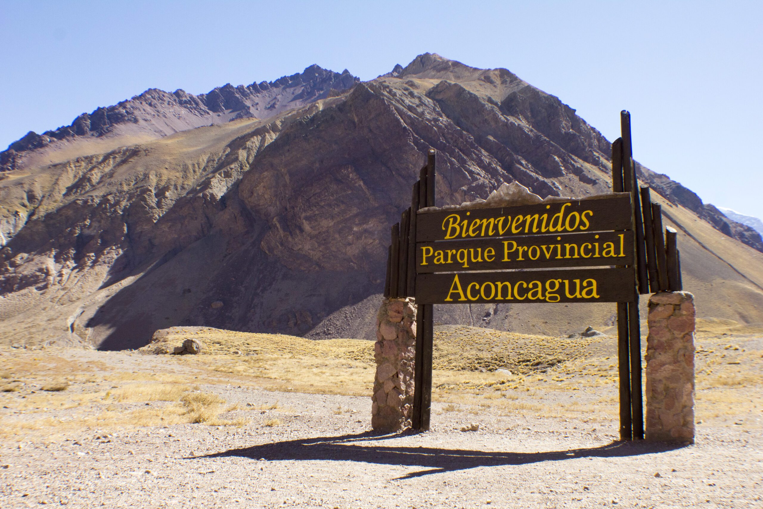
Get to El Palmar National Park by car and enjoy nature very close to Buenos Aires
Discover one of Argentina’s National Parks. Walk along paths between palm trees and dive into the Uruguay River. And on the way back, make a stop at the Ciervo de los Pantanos National Park.
When we plan a getaway near Buenos Aires, we often look at the beautiful Atlantic Coast. It is true that it is one of the favorite destinations, but not the only one. At Rentennials, we suggest you take a close look at what the province of Entre Ríos has to offer. The El Palmar National Park, along with cities and towns with history, make the province an unmissable place to visit.
A different landscape is present on the coast of the Uruguay River. Palm trees, beaches and the possibility of spending a few nights in a National Park. In addition, both on the way there and on the way back, you can make a stop at another protected area: the Ciervo de los Pantanos National Park.
Getting there is very simple. The best thing is to go with a car. If you prefer to use another one or you don’t have one, you just have to rent a car with Rentennials and start a trip of a few days.
In this article we provide you with all the information so that you can start planning your next trip to Entre Ríos.
El Palmar National Park
Two National Parks near Buenos Aires
To visit a National Park it is not necessary to go to Patagonia or the Argentine North. The Ciervo de los Pantanos National Park is only 65 km from the capital, while PN El Palmar is about 360 km away. Easy to access, affordable and ideal for all travelers.
Below we tell you more about these two places and what you can do in the surroundings.
The history of El Palmar National Park
El Palmar National Park was created in 1966 and its objective is to preserve the emblematic Butia yatay palm groves. In addition, there are sectors of Espinal, gallery forest and ecosystems unique in the country.
In this area, indigenous peoples such as the Charrúas and Guaranís lived. Later, the Jesuits settled, and today you can see this history with “La Calera del Palmar”.
What to do in El Palmar National Park
It is not just about walking along beautiful paths next to the palm trees, but about enjoying a few days in the middle of nature next to the river.
El Palmar National Park / Photo by @visitargentina
Trails
From the visitor center, pedestrian trails depart to enjoy the most beautiful places in the park. In addition, there are some that can be done by car.
Before reaching the visitor center, there is the trail to Mirador La Glorieta. It is about 1,000 meters long and starts and ends at the same place. It reaches a platform where you can see the banks of the El Palmar stream. It has beautiful views of this particular region.
Nearby, the Mirador del Palmar trail runs through gallery forests with the characteristic trees of the area.
From the campsite, the El Mollar trail starts. It is 1,400 meters long and very easy to walk.
The Yatay trail is only 600 meters long and, as its name indicates, shows the importance of the yatay palm tree.
From the intendencia, the last of the trails that lead to the Jesuit ruins starts.
The trails can be walked with an official guide or independently. In addition, there is the possibility of canoeing along one of the streams. For more information, ask at the park’s visitor center.
Beaches
In the National Park there is a beach that is a jewel of the Uruguay River. During the high season there are lifeguards. If you visit outside the summer months, entry into the water is not permitted.
El Palmar National Park Beach
Fauna and flora in El Palmar National Park
If you like nature tourism, particularly bird watching, then bring binoculars. You can also come across foxes, rheas and the friendly capybaras.
For those who like silence and tranquility, the early morning and evening hours are excellent times to meet the animals.
Fauna and flora of El Palmar National Park
How to get to El Palmar
From Buenos Aires, take the Pan-American Highway, Escobar branch, and then National Route 14. It is 360 km long and takes about 4 hours on the highway.
A recommendation: go slowly because there are many cameras that take photo tickets.
EMBEDDED MAP
Where to sleep
The classic El Palmar camping site is an excellent option. It is located 800 meters from the beach and has all the services to spend a few nights in comfort.
If you prefer something different, the Aurora del Palmar private reserve has restored train cars where you can sleep. It also has
a campsite. It is located in front of the National Park and has many activities in nature. For more information, visit their website.
Another option is to spend a few nights in Colón or San José, the two towns close to the Park. There you will find many accommodations of different categories.
Aurora del Palmar
What to visit around El Palmar National Park
Going to El Palmar allows you to visit some nearby places that are worth it. Colón, the San José Palace and Pueblo Liebig are interesting options to spend the day.
Colón
Here you will find beaches on the Uruguay River ideal for resting. The waters of the river are calm, which allows you to do sports activities such as kayaking, sailing or windsurfing. There are two beaches where you can sit, sunbathe and get into the water: the beach in the north zone and the one in the south zone. Both have lifeguard services, places to eat and bathrooms.
The Rivera Sur Urban Reserve and the Río de los Pájaros Park are two options to immerse yourself more in nature. And if you have more time, the Termas de Colón are perfect for relaxing.
Very close to Colón are the small towns of San José and Villa Elisa. Here there are some places for rural tourism and eating in old country stores, such as the Almacén Don Leandro. In San José there is the Molino Forclaz, an old mill that is now a museum. In addition, in Villa Elisa there are its thermal baths, another option for relaxing.
Liebig Village
Can you imagine visiting a town that is an open-air museum? This town was built especially for the employees who worked in a meat factory at the beginning of the 20th century. Corned Beef, the meat extract, was made here, which was exported to many places in Europe. Just 10 minutes from Coló you can see the vestiges of that time.
Today a National Historical Heritage Site, it is a very different experience if you visit with a guide. There are times when the groups leave to take the tour. Check their social media to find out the days and times.
Palacio San José
90 km south of El Palmar National Park, you will find one of the most iconic historical sites in Argentina. The Palacio San José and the Justo José de Urquiza National Historical Monument and Museum. It was the residence of the first constitutional president of Argentina and governor of the province of Entre Ríos, Justo José Urquiza. Its spectacular nature demonstrates the power of the leader during the 19th century. In this same place, on April 11, 1870, General Urquiza was assassinated in the south gallery of the Patio de Honor, at the door of his bedroom.
To visit it, it is best to do so with a guided tour. It opens from Tuesday to Sunday from 9:30 a.m. to 6:30 p.m.
Ciervo de los Pantanos National Park
One of the closest National Parks to Buenos Aires and, until now, little visited. It is ideal for a short stop on your way to or from El Palmar. A better option is to spend a day there on a getaway from Buenos Aires.
What is the Ciervo de los Pantanos National Park
It is located in the north of the province of Buenos Aires and was created in 2018. It protects biodiversity in a wetland environment where the marsh deer makes its presence felt. With a little luck and patience, you will be able to observe them.
In the past it was part of the Estancia Otamendi, a fundamental agricultural brick production center in the region. Today you can see vestiges of that time.
What to do in Ciervo de los Pantanos
Hiking, resting and bird watching (there are about 300 species so it is advisable to bring binoculars) are the main activities. The park is small, so it can easily be covered in a day.
Hiking and picnicking
There are two trails to explore the small National Park. Walking you will get to know the river forest, the ravines and the Pampas grasslands. The three trails are no more than 2 km long, are self-guided and of low difficulty.
The Historias del Pastizal trail is 1000 m long and shows what the typical Pampas grassland is like with some historical components of the Otamendi Ranch.
The Guardianes de la Barranca trail is only 300 meters long and reaches a viewpoint overlooking the wetland.
The Recuperando lo Nuestro trail leads to the Don Juan native plant nursery.
Swamp Deer National Park
Paraná de las Palmas
The Islas Malvinas public road leads to the Paraná de las Palmas pier. There you will find the river to contemplate it in its entirety or cross to the other side. If you choose to cross it, there are green spaces and campsites to continue enjoying the day.
How to get to Ciervo de los Pantanos National Park
It is located just 70 km away on National Route 9. Once you are in the town of Rómulo Otamendi, you have to take the main road for 2 km to the entrance to the Park.
EMBEDDED MAP
When is the best time to visit El Palmar and Ciervo de los Pantanos
Both parks can be visited all year round?
No, although in the summer the temperature rises and the walks become more complex. It is best to visit it between March and December.
Before going, check the forecast because with the rains there are trails that cannot be done and you cannot enjoy the parks in their entirety.
Rent a car to visit El Palmar National Park
To tour the National Parks closest to Buenos Aires, the car is an ally at all times. In case you do not have one or do not want to use yours, then look for the best place to rent a car in Buenos Aires.
If you are looking for price, quality and safety, consult Rentennials,which will provide you with the best options to make your getaway a reality.
We are Rentennials
Rentennials is the new way to rent cars from local hosts in your city, quickly, easily, and affordably. It's also your new path to starting your own car rental business and making money every month. Discover more.